The National Hurricane Center is tracking an invest, dubbed Invest 90-L, that has a 10% chance of forming over the next few days.According to the NHC, a trough of low pressure that started in the eastern Gulf of Mexico is producing a large area of disorganized showers and thunderstorms as it moves closer to Florida.At last check, the NHC located Invest 90-L near the west coast of Florida. It is expected to work northeast across the state as the week continues before moving off the southeast coast. Most of Central Florida saw rain on and off Tuesday, and the pattern is expected to continue on Wednesday.While the formation chance is low (near 10% in the next 48 hours and 20% in the next seven days), heavy rainfall is expected across portions of Central Florida through the end of the week.Some slow development is possible after the system moves off the east coast later this week, the NHC says.Invest is short for “investigation,” and refers to a weather feature that the NHC is investigating. It should be noted that it is NOT necessarily an area that is expected to develop into a tropical system. It’s simply an area being investigated for any number of reasons.Tracking the Tropics: What’s an invest?With this designation, the NHC is able to run models on the system.>> Click here to read WESH 2’s full 2024 hurricane season forecast>> Click here to watch WESH 2’s hurricane special, ‘Surviving the Season’
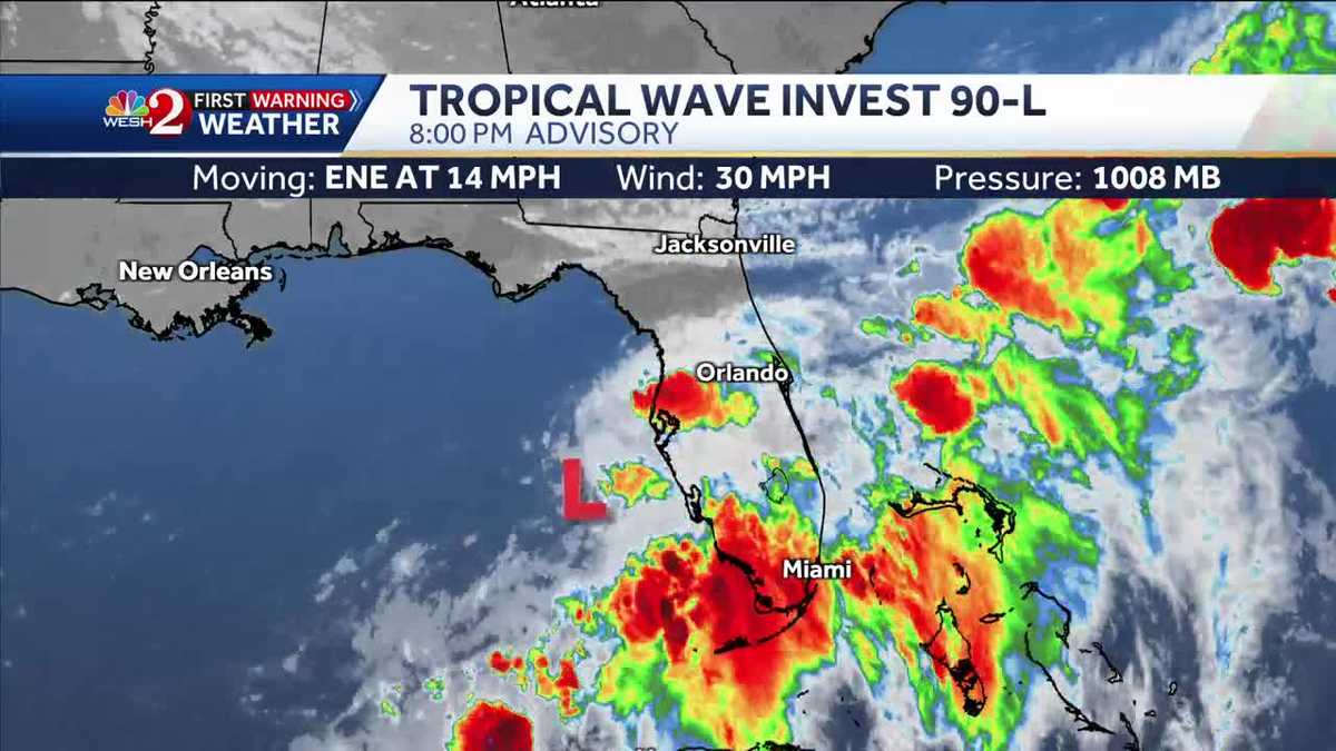
The National Hurricane Center is tracking an invest, dubbed Invest 90-L, that has a 10% chance of forming over the next few days.
According to the NHC, a trough of low pressure that started in the eastern Gulf of Mexico is producing a large area of disorganized showers and thunderstorms as it moves closer to Florida.
At last check, the NHC located Invest 90-L near the west coast of Florida. It is expected to work northeast across the state as the week continues before moving off the southeast coast.
Most of Central Florida saw rain on and off Tuesday, and the pattern is expected to continue on Wednesday.
While the formation chance is low (near 10% in the next 48 hours and 20% in the next seven days), heavy rainfall is expected across portions of Central Florida through the end of the week.
Some slow development is possible after the system moves off the east coast later this week, the NHC says.
This content is imported from Twitter.
You may be able to find the same content in another format, or you may be able to find more information, at their web site.
This content is imported from Twitter.
You may be able to find the same content in another format, or you may be able to find more information, at their web site.
This content is imported from Twitter.
You may be able to find the same content in another format, or you may be able to find more information, at their web site.
Invest is short for “investigation,” and refers to a weather feature that the NHC is investigating. It should be noted that it is NOT necessarily an area that is expected to develop into a tropical system. It’s simply an area being investigated for any number of reasons.
Tracking the Tropics: What’s an invest?
With this designation, the NHC is able to run models on the system.
This content is imported from Twitter.
You may be able to find the same content in another format, or you may be able to find more information, at their web site.
>> Click here to read WESH 2’s full 2024 hurricane season forecast
>> Click here to watch WESH 2’s hurricane special, ‘Surviving the Season’
#NHC #tracks #area #Florida #slight #development #chance,
#NHC #tracks #area #Florida #slight #development #chance
