Rivers will continue to surge and more storms could be on the way across the Midwest on Tuesday, as well as dangerously high temperatures, as the region reels from severe flood damage and widespread disruption.
Some 31 million people are at risk of severe weather Tuesday evening, with as much as 2 inches of rain per hour possible in parts of Missouri, Iowa, Illinois and Minnesota.
Potential storms Tuesday morning could bring hail bigger than 2 inches, winds of more than 60 mph and a few tornadoes, the National Weather Service warned.
At least two people are known to have died as a result of flooding.
The flooding has set records at various points along the Des Moines River Basin: the surge at Estherville, Iowa, was 17.14 feet as of 3:20 p.m. Monday and was forecast to rise even higher, according to the agency.
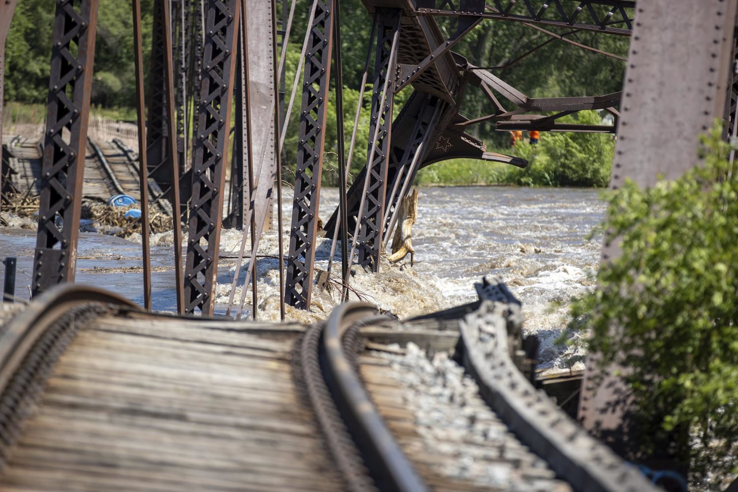
A railroad bridge connecting Sioux City, Iowa, to North Sioux City, South Dakota, collapsed Sunday night because of heavy rain and flooding and fell into the Big Sioux River.
Amy Gettner, of Sioux City, said she was getting ready for work early Monday morning and saw the area where the bridge had collapsed.
“I knew that was not a good sign,” she told NBC’s “TODAY” show.
Her husband, Rich Gettner, said he knows they will have “extensive” damage to their home after flood waters reached as high as their stoop.
“All the flooring’s probably gonna be ruined,” he said. “Anything that I wasn’t able to get up off the floor.”
The couple said they never expected the area to flood and said all the damage that has been left behind is “hard to see.”
Another woman said she and her husband had to escape in the middle of the night.
“We literally drove through everybody’s yard,” she said. “That was the only way out.”
More than 20 river locations are experiencing major flooding, with 29 forecasted to go into major flooding. The high river levels will continue through the end of the week as the water drains downstream. However, heavy rain is expected to return on Thursday and Friday and could lead to more flooding around rivers that have not had a chance to recede.
So far, almost 3 million people have been affected in South Dakota, Minnesota and Iowa, where President Joe Biden declared a major disaster Tuesday morning and pledged federal aid to support state, local and tribal recovery efforts.
The aid would go to “areas affected by severe storms, flooding, straight-line winds, and tornadoes beginning on June 16, 2024, and continuing,” a White House statement said.
Affected residents can apply at DisasterAssistance.gov.
There is a marginal to slight risk of more excessive rainfall causing more flash floods from Tuesday onward, with a slight risk warning in place for the middle Mississippi Valley.
The Sioux City Railroad Museum in Iowa posted pictures on Facebook showing exhibits underwater. Aerial pictures shot by a drone showed McCook Lake, west of Sioux City, had burst its banks and turned surrounding streets into rivers.
A dam in Minnesota was damaged Monday and was said by local officials to be at risk of imminent collapse, but there have been no moves to evacuate local people.
Extreme heat will only add to local difficulties, with temperatures in the upper 90s, possibly more than 100 degrees in places, expected over the central Plains and the Mississippi Valley and spreading into much of the Lower 48 states.
Around 70 million people are under heavy alerts from the Rockies and Plains to the Mid-Atlantic and Florida.
The high heat is expected to peak Wednesday for the D.C. to Boston corridor, but will remain for other regions including the Midwest and South throughout the week.
In Las Vegas, this month is set to be the hottest June on record, with temperatures 11 degrees higher than normal. An excessive heat warning is also in place for desert areas of Los Angeles County.
#Floods #extreme #heat #pose #dual #threat #Midwest #Biden #approves #federal #aid,
#Floods #extreme #heat #pose #dual #threat #Midwest #Biden #approves #federal #aid
