Michael Johnson and Morgan Kolkmeyer
Parts of Chicagoland should brace for some serious rain later Tuesday into Wednesday.
The remnants of Tropical Storm Beryl are moving up through southern Illinois on Tuesday morning and should arrive in Chicagoland by Tuesday afternoon.
With it will come tropical rain, which has the potential to drop heavy rainfall very quickly.
Meteorologists use a measurement called precipitable water, which essentially measures the moisture available in the air. A precipitable water level of 2 inches is very high, signaling significant rainfall potential.
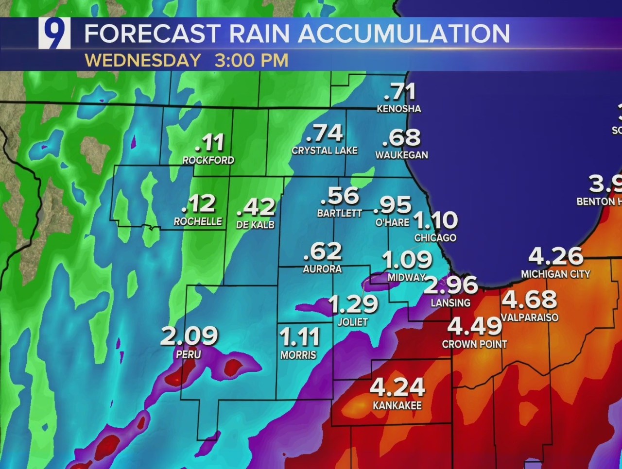
Areas in southeastern Chicagoland and Northwest Indiana fall under this level and will see the heaviest rainfall totals Tuesday and Wednesday, up to 3 to 5 inches.


This type of heavy rainfall also brings diminished visibility and high flooding potential, so Cook, Will, Kankakee and Grundy counties in Illinois and all of Northwest Indiana will be under a Flood Watch from 4 p.m. Tuesday to 1 p.m. Wednesday.

Areas to the north and west, however, are projected to receive much less rainfall from Beryl’s remnants. Meanwhile, high temperatures around Chicagoland on Tuesday will reach the low 80s.
Then, very hot and humid air will move into the area for the end of the week through the weekend, with dew points well into the 70s and air temperatures around 90.

Forecast
TODAY: Cloudy, tropical rain and storms, winds E at 5-10 mph. High: 82/78.
TONIGHT: Cloudy, tropical rain and storms, winds N at 5-15 mph, gusts to 25. Low: 66.
TOMORROW: Cloudy, tropical rain and storms, decreasing clouds, winds N at 5-10 mph, gusts to 15. High: 78.
#Parts #Chicagoland #dumped #remnants #Beryl #rain,
#Parts #Chicagoland #dumped #remnants #Beryl #rain
