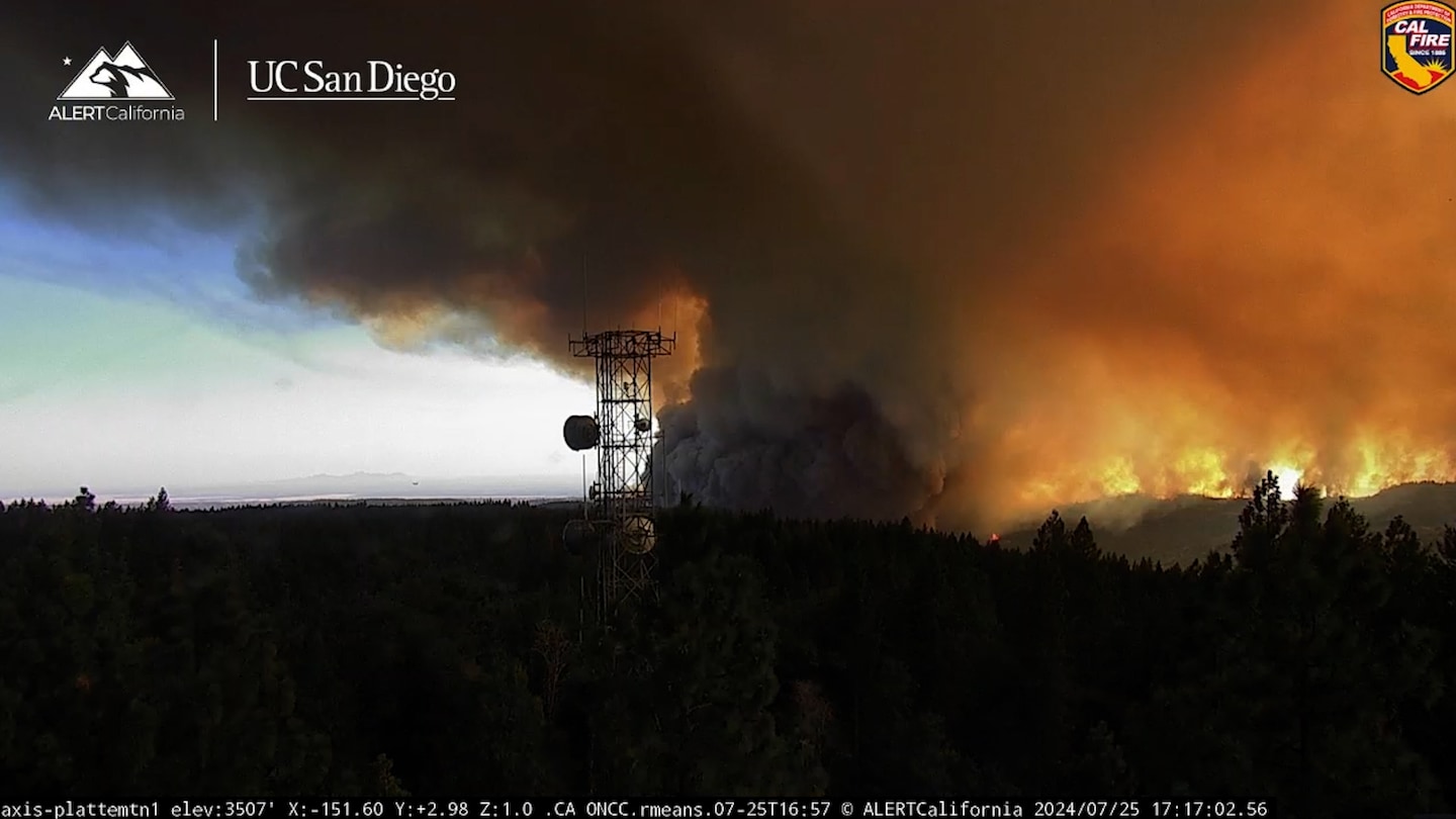
On Thursday, weakly changing winds with height helped sculpt the fire’s entire smoke plume into a pillar of rotation. Doppler radar indicates that, from that column of spinning smoke, one or more tornado-like vortexes formed within the massive plume. The radar showed low-level winds blowing in different directions at the location of the plume, which is often an indicator of a tornado.
Only after the fire — which is only 3 percent contained — is extinguished can the area be surveyed for possible wind damage to determine whether tornadoes actually occurred.
For now, a red flag warning remains in effect for portions of the northern Sacramento Valley, including Chico, Redding and Paradise. Relative humidity levels of 10 to 20 percent, along with high heat and winds gusting 20 to 30 mph, will promote the spread of fires and encourage the formation of new ones.
That could mean more fire tornadoes with the Park Fire on Friday afternoon, particularly as the sun bakes the lower atmosphere and temperatures top 100 degrees. Into the weekend, the heat will ease with cooler highs in the upper 80s to lower 90s. By the middle of next week, heat is forecast to return, with temperatures warming above 100 degrees again.
Thursday’s smoke plume reached at least 25,000 feet, and probably higher, behaving in essence as its own miniature thunderstorm and “feeling” the changing winds at different levels of the atmosphere. On rare occasions, exceptionally tall smoke plumes morph into thunderstorms of their own, becoming so-called pyrocumulonimbus clouds and spitting out their own lightning strikes. Sometimes those strikes start new fires.
Time-lapse videos from fire cameras operated by the University of California at San Diego captured Thursday’s rotating smoke plume whirling ominously against the backdrop of an orange and brown sky.
Fire tornadoes have happened before. The first recorded instance was near Canberra, Australia, during a wildfire on Jan. 18, 2003. Damage surveys were conducted and it was estimated that the vortex contained 160 mph winds. That was thought to be a freak event — until fire tornadoes became increasingly well-documented in the United States.
On July 26, 2018, the Carr Fire spawned a fire tornado with winds up to 143 mph, near Redding, Calif. The fire tornado uprooted trees, scoured the ground, toppled high-tension power lines and even collapsed a home, killing three occupants. A firefighter was also killed.
On Aug. 15, 2020, meteorologists at the National Weather Service office in Reno, Nev., detected strong rotation within a smoke plume, and opted to issue a fire tornado warning around the Loyalton Fire. It was burning in the Klamath National Forest in Lassen County, Calif. Multiple intense fire tornadoes touched down and were captured on video.
For now, firefighters combating the Park Fire should remain vigilant for additional fire-induced tornadoes, which could loft and spread embers, sparking new fires.
#Californias #Park #Fire #generated #suspected #fire #tornadoes #Heres,
#Californias #Park #Fire #generated #suspected #fire #tornadoes #Heres
