The National Weather Service confirmed six tornadoes hit Wisconsin Saturday.The National Weather Service said an EF-0 touched down near Cornelia in Grant County around 5:37 p.m. The path length was around 0.16 miles. It’s estimated that winds peaked at 75 miles per hour. Emergency management provided drone footage of a very short path of tree damage south of Highway O near North Lane. No structures were hit.The first twister happened around 7:10 p.m. in Dane County, two miles south of Marshall. There, winds peaked around 105 miles per hour, damaging farms, homes and trees. Officials said the EF-1 tornado lifted just south of Waterloo, traveling about 4.6 miles.About 20 minutes later, an EF-1 tornado developed west of Watertown near County Roads Q and T in Jefferson County. The tornado moved northeast for about 2.1 miles, damaging more farms, homes and trees along West Road. Winds also peaked around 105 miles per hour.Then, just before 8:30 Saturday night, an EF-1 tornado tore through Walworth County, two miles east of Fontana-on-Geneva Lake. Officials say it developed south of Geneva Lake, moving northeast before lifting south of Lake Como. Winds peaked around 100 miles per hour, uprooting trees, wrecking piers and damaging homes. Officials say this tornado traveled five miles. It mainly caused tree damage but some planks from the lake docks were thrown over 500 yards.At the same time, another EF-1 tornado hit Walworth County, two miles east of Delavan. Winds peaked around 105 miles per hour. Officials say it traveled six miles, ending outside of Williams Bay where a number of homes lost parts or most of their roofs.The National Weather Service confirmed an EF-2 tornado also hit Rock county near Janesville, where winds peaked around 115 miles per hour. Right now, details are limited. We will continue to update you online and on-air as information is released.The National Weather Service was supposed to survey Argyle on June 23, but due to the extensive damage in the Janesville area they rescheduled the storm damage survey for Monday morning. The National Weather Service has not reported any injuries.For more WISN 12 News weather coverage, click here. You can also customize weather alerts for your area using our mobile app.
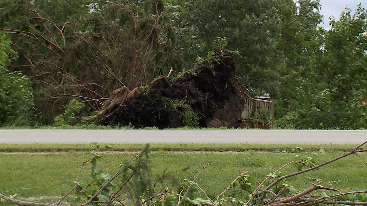
The National Weather Service confirmed six tornadoes hit Wisconsin Saturday.
The National Weather Service said an EF-0 touched down near Cornelia in Grant County around 5:37 p.m. The path length was around 0.16 miles. It’s estimated that winds peaked at 75 miles per hour. Emergency management provided drone footage of a very short path of tree damage south of Highway O near North Lane. No structures were hit.
The first twister happened around 7:10 p.m. in Dane County, two miles south of Marshall. There, winds peaked around 105 miles per hour, damaging farms, homes and trees. Officials said the EF-1 tornado lifted just south of Waterloo, traveling about 4.6 miles.
About 20 minutes later, an EF-1 tornado developed west of Watertown near County Roads Q and T in Jefferson County. The tornado moved northeast for about 2.1 miles, damaging more farms, homes and trees along West Road. Winds also peaked around 105 miles per hour.
Then, just before 8:30 Saturday night, an EF-1 tornado tore through Walworth County, two miles east of Fontana-on-Geneva Lake. Officials say it developed south of Geneva Lake, moving northeast before lifting south of Lake Como. Winds peaked around 100 miles per hour, uprooting trees, wrecking piers and damaging homes. Officials say this tornado traveled five miles. It mainly caused tree damage but some planks from the lake docks were thrown over 500 yards.
At the same time, another EF-1 tornado hit Walworth County, two miles east of Delavan. Winds peaked around 105 miles per hour. Officials say it traveled six miles, ending outside of Williams Bay where a number of homes lost parts or most of their roofs.
The National Weather Service confirmed an EF-2 tornado also hit Rock county near Janesville, where winds peaked around 115 miles per hour. Right now, details are limited. We will continue to update you online and on-air as information is released.
The National Weather Service was supposed to survey Argyle on June 23, but due to the extensive damage in the Janesville area they rescheduled the storm damage survey for Monday morning.
The National Weather Service has not reported any injuries.
For more WISN 12 News weather coverage, click here. You can also customize weather alerts for your area using our mobile app.
#tornadoes #confirmed #Wisconsin,
#tornadoes #confirmed #Wisconsin
