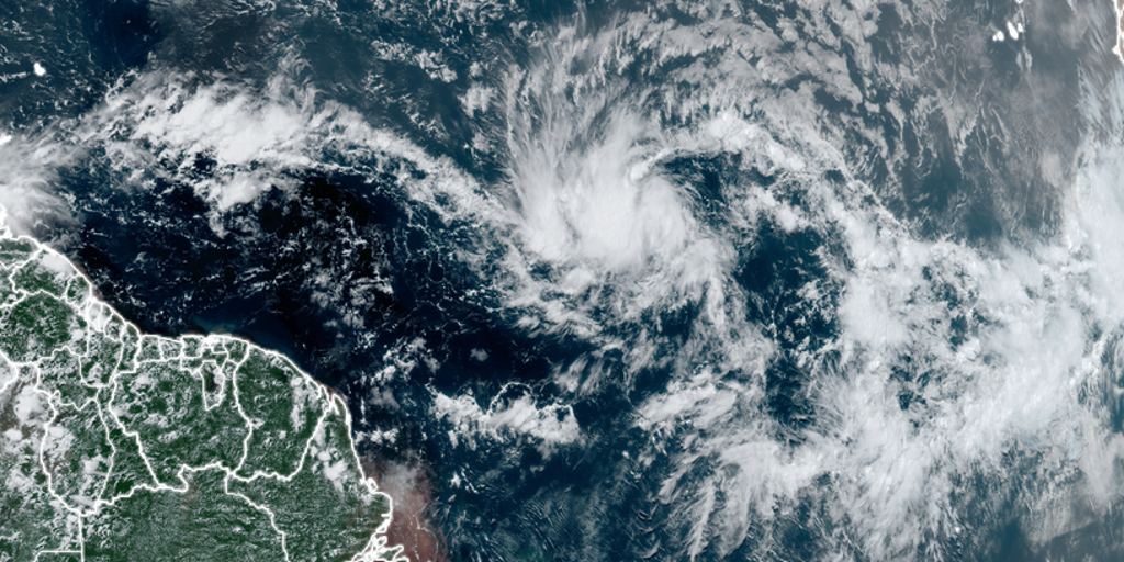
Islands that make up the Lesser and Greater Antilles are watching for the arrival of what could be Beryl over the weekend and into next week
Tropical Depression Two formed Friday evening east of the Caribbean islands in the tropical Atlantic, and it’s expected to strengthen into a tropical storm and possibly a hurricane as it heads west toward the Caribbean.
The National Hurricane Center (NHC) has been tracking this system, formerly Invest 95L, for development over the last few days. Satellite imagery on Friday indicated the system had gained enough organization to be classified as a tropical depression.
Tropical Depression Two will be named Beryl once the NHC determines its maximum sustained winds reach at least 39 mph. Once sustained wind speeds reach at least 74 mph, the cyclone would be classified as a hurricane.
2024 ATLANTIC HURRICANE SEASON GUIDE: HERE’S WHAT TO KNOW ABOUT THIS YEAR’S STORMS
Where is Tropical Depression 2?
Tropical Depression Two is located in the tropical Atlantic less than 1,200 miles east-southeast of Windward Islands and is not a threat to any landmasses during the next 36 hours.

(FOX Weather)
What is the forecast for Tropical Depression 2?
Tropical Depression Two is expected to continue strengthening over the next few days and soon become Tropical Storm Beryl by Saturday as it continues to move west, likely reaching the Windward Islands by the end of the weekend. Hurricane or Tropical Storm Watches could be required for portions of that region within the next 24 hours, the NHC adds.
On the projected track, Beryl is expected to intensify into a hurricane around the Caribbean islands before weakening late next week in the Caribbean.
“Typically, the atmospheric environment is unfavorable for intensification in this portion of the Atlantic basin in late June. However, the overall atmospheric and oceanic conditions appear conducive for steady strengthening during the next few days,” NHC forecasters stated.
Depending on where the cyclone strengthens into a hurricane, it could become one of the furthest east-forming hurricanes on record, as systems usually wait until the Caribbean or the Gulf of Mexico to become a Category 1 storm on the Saffir-Simpson Hurricane Wind Scale.

Disturbance No. 3 looms just east of TD 2
A disturbance just to the east of Tropical Depression 2 is just a few hundred miles south-southwest of the Cabo Verde Islands and producing disorganized showers and thunderstorms.

(FOX Weather)
Some slow development of this system is possible early next week while it moves generally westward across the central and western tropical Atlantic at 15 to 20 mph, according to the NHC.
It currently has a 30% chance of development within the next week.
Invest 94L eyes Central America, Mexico
Another disturbance dubbed Invest 94L is moving through the Caribbean toward Central America and southern Mexico, bringing the possibility of heavy and dangerous rainfall.

(FOX Weather)
The NHC is giving this system a low chance of developing. If it does, it would likely be in the far western Caribbean or the extreme southern Gulf of Mexico, if the system survives its trek across land, Norcross said.
“On the current schedule, the disturbance will impact Central America and move into the southern Gulf over the weekend,” he explained. “High pressure across the southern U.S. should keep the system well to the south.”
#Tropical #Depression #forms #Atlantic #Beryl,
#Tropical #Depression #forms #Atlantic #Beryl
